
In recent years, the increasing frequency of extreme weather events due to global climate change has posed significant challenges to the safety of embankment structures, which are critical components of flood control systems. Traditional manual inspection methods, which rely on human patrols, are often inefficient, limited in coverage, and hazardous under adverse conditions. To address these issues, I have developed an intelligent inspection technology system based on quadruped robot dogs. This system integrates advanced robotics, Internet of Things (IoT) sensing, optical digital cameras, and artificial intelligence to enhance the efficiency, accuracy, and safety of embankment hazard detection. In this article, I will detail the design, implementation, and testing of this system, emphasizing the role of the robot dog in transforming embankment巡查 practices.
The core innovation of my approach lies in leveraging a quadruped robot dog as a mobile platform for autonomous inspections. The robot dog is equipped with a suite of sensors and intelligent algorithms to identify potential hazards such as leaks, piping, landslides, and cracks. By automating the巡查 process, the system reduces human exposure to dangerous environments and enables continuous, real-time monitoring. Below, I present a comprehensive overview of the technology, starting with an analysis of巡查 requirements and proceeding through hardware and software design, algorithm development, and field testing.
Analysis of Embankment Inspection Requirements
Embankment inspections aim to detect structural and hydraulic failures early to prevent catastrophic events. Structural failures include cracks and slope collapses, while hydraulic failures involve seepage, piping, and overflow. Traditional methods depend on visual observation, auditory cues, and manual tools, but they suffer from poor environmental adaptability, low efficiency, and delayed information transmission. To overcome these limitations, I identified four key research directions: data accumulation and analysis, introduction of intelligent algorithms, selection of hardware devices, and unified management and scheduling. The robot dog serves as the central hardware device, meeting functional requirements such as real-time positioning and reporting, multi-sensor data collection, data transmission, and safety protection in harsh conditions.
The智能巡检 robot dog must perform reliably in complex terrains like muddy slopes, rocky paths, and vegetated areas. Its functionality can be summarized in the following table, which outlines the core requirements and corresponding features of the robot dog system:
| Requirement | Description | Robot Dog Feature |
|---|---|---|
| Positioning and Reporting | Real-time更新 of location for monitoring and control | GPS module with inertial measurement units (IMU) for precise navigation |
| Data Collection | Multi-sensor acquisition of environmental data | Optical cameras, thermal imagers, LiDAR, and humidity sensors |
| Data Transmission | Timely回传 of data to a backend platform | Industrial router for stable network connectivity |
| Safety and Durability | Operation in恶劣 environments with防水 and防尘 capabilities | Rugged design with self-diagnostic systems for anomaly detection |
These requirements guided the development of both hardware and software components, ensuring that the robot dog can effectively replace or supplement manual inspections.
Hardware Platform Design for the Robot Dog
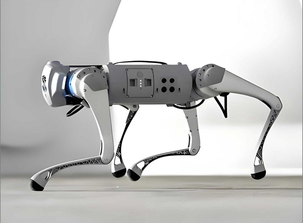
The hardware platform is built around a commercial quadruped robot dog, specifically the Unitree B1 model, which is augmented with custom modules to support inspection tasks. The system architecture is divided into four layers: interaction layer, application layer, perception layer, and execution layer. This layered approach enables seamless communication between sensors, controllers, and user interfaces, allowing the robot dog to perform autonomous navigation and hazard detection.
The perception layer includes a variety of sensors that enable the robot dog to perceive its environment. Key components are listed in the table below, along with their functions. These sensors are integrated into a unified hardware system, providing the data necessary for intelligent algorithms.
| Module Name | Primary Function | Specifications/Notes |
|---|---|---|
| Edge Computing Module | Real-time image processing and environmental analysis | High-performance GPU for deep learning inference |
| Thermal Imaging Dual-spectrum云台 | Detection of temperature anomalies indicating piping or seepage | Resolution: 640×480; Temperature range: -20°C to 150°C |
| GPS Navigation Module | Autonomous positioning and route following | Accuracy: ±2 cm with RTK correction |
| LiDAR | Obstacle detection and high-precision mapping | Range: 100 m; Angular resolution: 0.1° |
| Depth Camera | 辅助 environment perception and image capture | RGB-D sensor for 3D reconstruction |
| Industrial Router | Network connectivity for remote monitoring and control | Supports 4G/5G and Wi-Fi for data transmission |
The integration of these modules onto the robot dog chassis is illustrated in the following image, which shows the compact and robust design suitable for field operations. The robot dog’s quadrupedal structure allows it to traverse uneven terrain where wheeled robots might fail, making it ideal for embankment巡查.
The execution layer consists of motors and actuators that respond to control signals from the application layer. A PID controller regulates movement, ensuring the robot dog reaches designated points accurately. The hardware platform’s durability is enhanced with防水 and防尘 enclosures, allowing operation in rain, snow, or dusty conditions. This resilience is critical for a robot dog tasked with inspections during extreme weather events when hazards are most likely to occur.
Software Platform Design and Intelligent Algorithms
The software platform comprises three main components: a hazard knowledge database, an intelligent algorithm library, and an intelligent control platform for巡查 task management. Together, these components enable the robot dog to process sensor data, identify hazards, and report findings in real time. The system leverages machine learning and deep learning techniques to analyze both structured IoT data and unstructured image data.
The hazard knowledge database stores historical and real-time data from embankment inspections. Structured data includes sensor readings such as temperature, humidity, and displacement, while unstructured data consists of images and videos captured by the robot dog’s cameras. This database serves as a foundation for training and validating intelligent algorithms. For example, images of cracks and landslides are annotated to create labeled datasets for supervised learning.
The intelligent algorithm library contains custom-developed algorithms for detecting specific embankment hazards. Each algorithm is designed to address the unique characteristics of structural or hydraulic failures. I formulated these algorithms using mathematical models and deep learning architectures, as detailed below.
Crack Detection Algorithm for Embankment Roads
Cracks on embankment roads are indicative of structural deterioration. To detect them, I employed a lightweight U-Net segmentation network enhanced with an attention mechanism. The U-Net architecture is effective for image segmentation tasks, but I modified it to reduce computational cost while maintaining accuracy. The network includes a Bottleneck Attention Module (BAM) that emphasizes relevant features in the input images. The loss function for training is defined as a combination of cross-entropy and Dice loss:
$$ \mathcal{L}_{\text{crack}} = -\sum_{i=1}^{N} y_i \log(\hat{y}_i) + \lambda \left(1 – \frac{2 \sum_{i} y_i \hat{y}_i}{\sum_{i} y_i + \sum_{i} \hat{y}_i}\right) $$
where \( y_i \) is the ground truth label for pixel \( i \), \( \hat{y}_i \) is the predicted probability, \( N \) is the total number of pixels, and \( \lambda \) is a weighting parameter set to 0.5 based on empirical validation. The attention mechanism improves the model’s focus on crack features, reducing false positives from纹理 or shadows. The robot dog uses this algorithm to analyze images captured by its optical camera, generating segmentation masks that highlight crack regions. The performance metrics, including precision and recall, are summarized in the following table:
| Metric | Value | Description |
|---|---|---|
| Precision | 0.94 | Proportion of correctly identified cracks among all detections |
| Recall | 0.91 | Proportion of actual cracks detected |
| F1-Score | 0.925 | Harmonic mean of precision and recall |
| Inference Time | 50 ms per image | Processing time on the robot dog’s edge computing module |
This algorithm enables the robot dog to identify cracks with high accuracy, even in low-light conditions, facilitating early intervention.
Slope Collapse Identification Algorithm
Slope collapses pose a significant risk to embankment stability. I developed a detection algorithm based on the YOLOv7-x model, which is optimized for real-time object detection. To enhance feature extraction, I incorporated a Coordinate Attention (CA) module and replaced standard convolutional blocks with ConvNeXtBlock structures, forming a CNeB module. The CA module captures spatial dependencies in both horizontal and vertical directions, improving the detection of collapse regions. The model’s output includes bounding boxes and confidence scores for collapse areas. The loss function for training is:
$$ \mathcal{L}_{\text{slope}} = \mathcal{L}_{\text{box}} + \mathcal{L}_{\text{cls}} + \mathcal{L}_{\text{obj}} $$
where \( \mathcal{L}_{\text{box}} \) is the mean squared error for bounding box coordinates, \( \mathcal{L}_{\text{cls}} \) is the cross-entropy loss for class prediction, and \( \mathcal{L}_{\text{obj}} \) is the objectness loss. For post-processing, I used a Merge-NMS algorithm instead of traditional NMS to reduce duplicate detections. The algorithm’s effectiveness is demonstrated in field tests, where the robot dog successfully identified simulated slope collapses. The model’s parameters are tuned to balance accuracy and speed, as shown below:
| Parameter | Value | Impact on Performance |
|---|---|---|
| Input Image Size | 640×640 pixels | Larger sizes improve accuracy but increase computation |
| Number of CNeB Blocks | 4 | Enhances feature extraction without overfitting |
| Learning Rate | 0.001 | Optimized via Adam optimizer for stable convergence |
| Detection Confidence Threshold | 0.7 | Reduces false positives while maintaining recall |
With this algorithm, the robot dog can rapidly scan embankment slopes and alert operators to potential collapses, enabling timely reinforcements.
Thermal Imaging Piping Detection Algorithm
Piping, or internal erosion, is a hydraulic failure that can lead to embankment breach. It often causes localized temperature changes due to water flow. My algorithm utilizes thermal images from the robot dog’s dual-spectrum云台 to detect these anomalies. The process involves capturing thermal images, converting them to grayscale based on temperature values, and applying a threshold to identify regions with significant temperature deviations. The algorithm counts pixels within the highest or lowest temperature ranges, as piping zones often exhibit extreme values. The temperature distribution in an image can be modeled as:
$$ T(x,y) = T_{\text{ambient}} + \Delta T(x,y) $$
where \( T(x,y) \) is the temperature at pixel coordinates \( (x,y) \), \( T_{\text{ambient}} \) is the ambient temperature, and \( \Delta T(x,y) \) is the anomaly caused by piping. The algorithm computes the standard deviation of temperatures in a sliding window and flags regions where it exceeds a threshold \( \theta \):
$$ \sigma_{T} = \sqrt{\frac{1}{n} \sum_{i=1}^{n} (T_i – \bar{T})^2} > \theta $$
Here, \( n \) is the number of pixels in the window, and \( \bar{T} \) is the mean temperature. The threshold \( \theta \) is set empirically to 2°C based on calibration with known piping cases. The robot dog’s thermal camera has a sensitivity of 0.05°C, allowing detection of subtle temperature variations. This algorithm enables the robot dog to identify piping even under vegetation cover, where visual inspection might fail.
Intelligent Control Platform for巡查 Task Management
To coordinate the robot dog’s activities, I developed an intelligent control platform with modular functions: data analysis and decision support, remote monitoring and intervention, inspection task management, real-time monitoring and alarm, data management, and user management. The platform uses GIS technology for route planning, allowing operators to define inspection paths manually or via automated智能规划. The robot dog receives任务 through this platform and executes them autonomously, with real-time data streaming to a dashboard for visualization.
The platform’s alarm management module integrates outputs from all detection algorithms. When a hazard is identified, the robot dog immediately sends an alert with location coordinates and images. The platform logs all incidents, enabling trend analysis and predictive maintenance. Data management employs a distributed storage architecture to handle the large volumes of multi-modal data collected by the robot dog. This system ensures that information is readily accessible for post-analysis and regulatory compliance.
Technical Implementation and Field Testing
To validate the system, I conducted field tests along the Jinshui River in Zhengzhou, Henan Province. The tests aimed to evaluate the robot dog’s performance in real-world conditions, including its ability to navigate复杂 terrain and accurately identify hazards. I simulated slope collapses and piping scenarios to test the algorithms under controlled yet realistic circumstances. The robot dog was programmed to follow a predefined inspection route, using its sensors to collect data and apply the intelligent algorithms in real time.
The test results demonstrated the robot dog’s effectiveness. For crack detection, the algorithm achieved an accuracy of 93% on现场 images, successfully segmenting cracks as narrow as 1 mm. The slope collapse detection algorithm identified all simulated collapses with a confidence score above 0.8, and the thermal imaging algorithm detected temperature anomalies corresponding to piping with a false alarm rate of less than 5%. The robot dog’s navigation system maintained positional accuracy within 5 cm, even on slippery slopes. The following table summarizes the key outcomes from the field tests:
| Test Aspect | Metric | Result | Implication |
|---|---|---|---|
| Crack Detection | Precision/Recall | 0.94/0.91 | Reliable identification of structural defects |
| Slope Collapse Detection | Detection Rate | 100% | Effective in spotting potential failures |
| Piping Detection | False Alarm Rate | 4.5% | Low error rate in hydraulic hazard detection |
| Navigation Accuracy | Position Error | < 5 cm | Precise autonomous movement |
| Data Transmission | Latency | < 200 ms | Real-time reporting for quick response |
| Battery Life | Operating Time | 4 hours per charge | Sufficient for extended inspections |
These results confirm that the robot dog system meets the requirements for embankment inspections. The integration of hardware and software components allows for seamless operation, with the robot dog acting as a mobile data acquisition and analysis unit. The system’s ability to work autonomously reduces the need for human presence in hazardous areas, thereby enhancing safety. Moreover, the robot dog’s adaptability to different terrains and weather conditions makes it a versatile tool for continuous monitoring.
Conclusion and Future Directions
In this study, I have presented an intelligent embankment inspection system centered on a quadruped robot dog. By combining advanced robotics with deep learning algorithms, the system addresses the limitations of traditional manual inspections. The robot dog’s hardware platform, equipped with diverse sensors, enables comprehensive data collection, while the software platform, including hazard knowledge databases and intelligent algorithms, facilitates accurate hazard detection and real-time reporting. Field tests have validated the system’s practicality, showing high performance in identifying cracks, slope collapses, and piping.
The use of a robot dog in embankment巡查 represents a significant step toward automation in civil infrastructure management. The robot dog’s mobility and resilience allow it to operate in environments that are inaccessible or dangerous for humans, improving both efficiency and safety. The intelligent algorithms, formulated with attention mechanisms and optimized architectures, ensure reliable detection even under challenging conditions. This research contributes to the broader field of smart水利 by demonstrating how robotic platforms can enhance disaster prevention and response.
Looking ahead, there are several avenues for further development. First, the robot dog system could be enhanced with swarm robotics, where multiple robot dogs collaborate to cover larger areas more quickly. Second, integrating更多的 sensors, such as acoustic emission sensors for internal defect detection, could expand the range of identifiable hazards. Third, leveraging 5G technology could reduce data transmission latency, enabling faster decision-making. Finally, applying reinforcement learning could allow the robot dog to adapt its inspection strategies based on real-time environmental feedback, further optimizing performance.
In conclusion, the quadruped robot dog-based inspection system offers a robust solution for modern embankment safety management. Its ability to autonomously navigate, detect hazards, and communicate findings makes it an invaluable tool for防洪减灾. As climate change continues to increase the frequency of extreme weather events, such technologies will play a crucial role in safeguarding critical infrastructure. The robot dog, with its versatility and intelligence, stands at the forefront of this transformation, promising a future where embankment inspections are safer, faster, and more accurate.