
The increasing complexity of modern infrastructure, particularly in underground transportation and utility networks, demands more intelligent, efficient, and safe methods for inspection and monitoring. Traditional tunnel surveying techniques, which often rely on manual labor or stationary equipment, are fraught with limitations including significant safety risks, low operational efficiency, and inadequate coverage in complex, confined, or hazardous terrains. The advent of sophisticated bionic robot platforms, especially those mimicking the morphology and locomotion of quadrupedal animals, presents a paradigm shift. Leveraging rapid advancements in artificial intelligence, robotics, and high-speed communication networks, these agile machines offer unprecedented capabilities for autonomous navigation and multi-sensor data acquisition in challenging environments. This article delves into the application of a highly dynamic, sensor-integrated bionic robot platform for comprehensive tunnel inspection, with a focused analysis on its performance in data acquisition, real-time processing, and three-dimensional (3D) reconstruction under typical operational constraints such as low-light conditions and repetitive structural features.
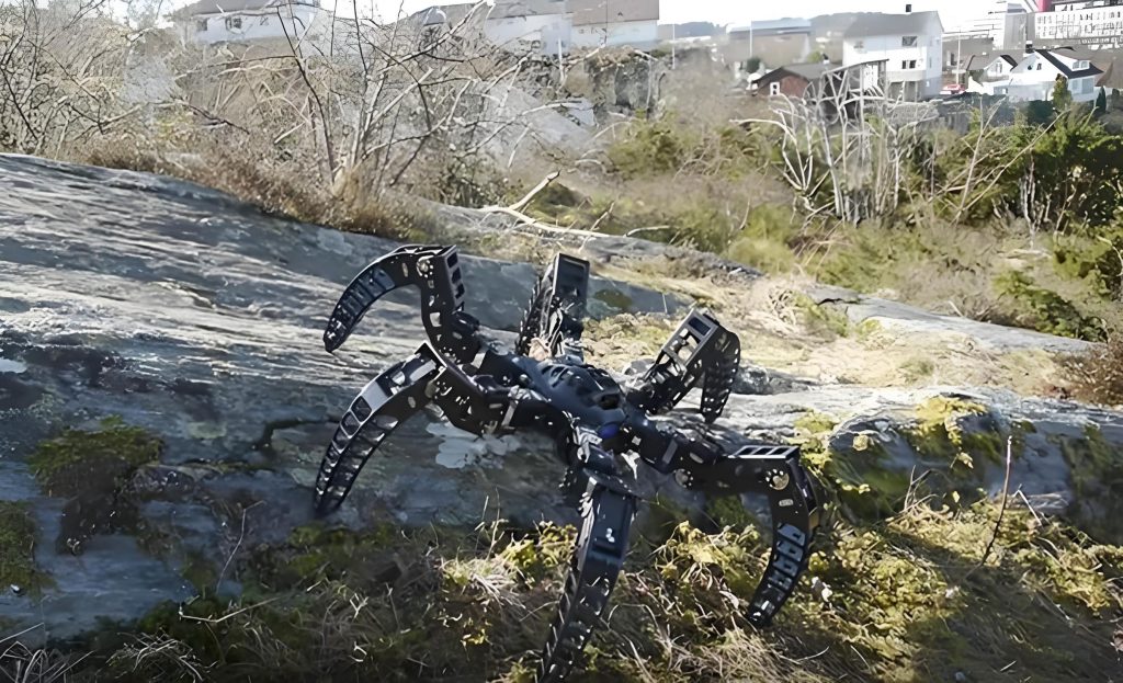
The core of this bionic robot platform lies in its bio-inspired mechanical design, which provides exceptional mobility over uneven surfaces, stairs, and debris, coupled with a robust suite of perception sensors. This integration transforms the bionic robot from a mere mobile platform into a versatile data acquisition node. The primary sensory payload for tunnel mapping typically includes a 3D Light Detection and Ranging (LiDAR) scanner, an Inertial Measurement Unit (IMU), and a panoramic camera system. The synergistic operation of these sensors enables the platform to construct dense, colored 3D point clouds of the tunnel interior, which serve as the digital twin for various engineering analyses.
Principles of the Integrated Perception System
The efficacy of the bionic robot in precise mapping is governed by the fundamental principles of its sensors and the algorithms that fuse their data. Each component plays a critical role in the Simultaneous Localization and Mapping (SLAM) pipeline.
LiDAR Ranging Principle
The LiDAR sensor is the primary source of geometric data. It operates by emitting pulsed laser beams and measuring the time-of-flight (ToF) for the reflection to return. The distance \( d \) to a target point is calculated based on the constant speed of light \( c \):
$$ d = \frac{c \cdot \Delta t}{2} $$
where \( \Delta t \) is the measured round-trip time. By rapidly steering the laser across the field of view, the sensor generates a dense set of 3D distance measurements, known as a point cloud. For a bionic robot navigating a tunnel, this results in millions of points precisely capturing the walls, ceiling, floor, and any installed fixtures or cables.
IMU for Motion State Estimation
While LiDAR provides accurate but sparse-in-time positional updates, the IMU supplies high-frequency estimates of the platform’s linear acceleration and angular velocity. By integrating these measurements, the bionic robot‘s ego-motion between LiDAR scans can be predicted. The equations for dead reckoning using IMU data are:
$$ \mathbf{v}(t) = \mathbf{v}_0 + \int_{0}^{t} \mathbf{a}(\tau) \, d\tau $$
$$ \mathbf{p}(t) = \mathbf{p}_0 + \int_{0}^{t} \mathbf{v}(\tau) \, d\tau $$
where \( \mathbf{a}(t) \) is the measured acceleration (after compensating for gravity), \( \mathbf{v}(t) \) is the velocity, and \( \mathbf{p}(t) \) is the position. The IMU data is crucial for providing an initial guess for scan matching and compensating for high-frequency motion distortions within a single LiDAR sweep, which is vital for a moving platform like a bionic robot.
Sensor Fusion and 3D Mapping Algorithm
The integration of LiDAR and IMU data is typically achieved within a SLAM framework such as FastLIO (Fast LiDAR-Inertial Odometry). This algorithm tightly couples the measurements in a kalman filter or optimization-based framework. The process involves:
- IMU Pre-integration: Predicting the change in pose between two LiDAR keyframes using IMU data, reducing the drift inherent in pure inertial navigation.
- Point Cloud Registration: Aligning the new LiDAR scan to the existing global map or a local submap using algorithms like Iterative Closest Point (ICP) or Normal Distributions Transform (NDT).
- Joint Optimization: Minimizing a cost function that balances the error between the predicted pose (from IMU) and the observed pose (from LiDAR scan matching).
- Map Update: Injecting the newly registered and corrected point cloud into a persistent global 3D map.
The panoramic camera operates synchronously, capturing 360° visual imagery. Each LiDAR point can be assigned an RGB color value from the corresponding pixel in the panoramic image, resulting in a photorealistic 3D model. This colored point cloud is invaluable for visual inspection, asset identification, and condition assessment.
| Sensor | Primary Function | Key Metric / Principle | Role in Tunnel Mapping |
|---|---|---|---|
| 3D LiDAR | Geometric Data Acquisition | Time-of-Flight (ToF) Ranging | Creates the structural skeleton of the 3D tunnel map. |
| IMU | Ego-motion Estimation | Newtonian Mechanics, Integration | Provides high-frequency pose updates, de-skews LiDAR scans. |
| Panoramic Camera | Visual / Texture Data Acquisition | Multi-lens or Fisheye Projection | Adds color and texture to the point cloud for visual analysis. |
| Onboard Computer | Data Fusion & SLAM Processing | FastLIO / LOAM Algorithm Family | Fuses sensor data in real-time to build and localize within the 3D map. |
Engineering Deployment and Field Application Protocol
To validate the practical capabilities of the bionic robot platform, a field test was conducted in an operational underground cable utility tunnel. The environment presented classic challenges: long, feature-poor corridors, varying light conditions, and the presence of installed infrastructure creating obstacles.
The deployment protocol was meticulously planned:
- Platform Preparation and Deployment: Due to access constraints via narrow maintenance shafts, a compact form-factor bionic robot was selected. It was transported to the entry point and lowered into the tunnel.
- Mission Execution: The bionic robot was remotely piloted along a predetermined route spanning approximately 530 meters between two access points. The mission involved a round trip, totaling about 1,100 meters of traversal. The platform performed a series of locomotive tasks:
- Stable linear walking at a cruise speed of ~0.5 m/s.
- Negotiating minor gradients and surface irregularities.
- Executing 180-degree turn maneuvers in confined spaces.
- Dynamic obstacle avoidance around cable trays and junction boxes.
- Concurrent Data Acquisition: Throughout the traversal, all sensors were active. The LiDAR and IMU streamed data to the onboard SLAM processor, while the panoramic camera captured imagery at regular intervals or triggered by distance traveled.
| Parameter Category | Details / Value |
|---|---|
| Test Environment | Urban Underground Cable Utility Tunnel |
| Traversal Distance (Round Trip) | ≈ 1,100 meters |
| Average Operational Speed | 0.5 meters/second |
| Primary Locomotion Tasks | Linear Walk, Turning, Grade Negotiation, Obstacle Avoidance |
| Total Mission Time (Data Acquisition) | 65 minutes |
| Key Environmental Challenges | Low/Uneven Lighting, Repetitive Wall Features, Confined Space |
Analysis of Results and System Performance
The field test yielded significant qualitative and quantitative results, demonstrating the maturity of the bionic robot platform for industrial inspection tasks.
Locomotion and Deployment Efficacy
The bionic robot demonstrated robust mobility, successfully completing all basic and advanced motion commands required for the inspection. Its compact size was a critical advantage, allowing access and maneuverability in spaces prohibitive for larger robots or human workers. The platform maintained stable operation for the full mission duration and beyond, indicating sufficient battery life and thermal management for typical inspection cycles.
Data Acquisition and Mapping Accuracy
The primary output was a dense, colored 3D point cloud of the entire tunnel section. The SLAM algorithm successfully compensated for the challenging visual and geometric environment. The integration of IMU data was essential to prevent tracking loss in areas with low geometric feature distinctiveness. The final reconstructed model showed high continuity and consistency, with no visible gaps or major misalignments at the loop closure point (return to the start position). The colorization from the panoramic imagery was accurately mapped onto the geometry, providing immediate visual context.
The quality of the captured data can be evaluated against key point cloud metrics. Let \( P = \{p_1, p_2, …, p_n\} \) represent the acquired point cloud, where each point \( p_i \) has coordinates \((x_i, y_i, z_i)\) and color \((r_i, g_i, b_i)\). The density \( \rho \) of the point cloud in a given tunnel segment of surface area \( S \) is a critical measure of detail:
$$ \rho = \frac{n}{S} $$
A high \( \rho \) indicates finer detail capture, crucial for identifying small cracks or defects. Furthermore, the mapping accuracy can be inferred from the consistency of repeated scans of the same object. The mean alignment error \( \epsilon \) between two registered point clouds \( P \) and \( Q \) (e.g., from the outbound and return journey) is given by:
$$ \epsilon = \frac{1}{m} \sum_{j=1}^{m} || \mathbf{T}(p_j) – q_j || $$
where \( \mathbf{T} \) is the optimal transformation found during registration, and \( (p_j, q_j) \) are corresponding point pairs. A low \( \epsilon \) value signifies high precision and reliability of the SLAM process executed by the bionic robot.
| Aspect | Traditional Manual/Sensor Methods | Quadruped Bionic Robot Platform |
|---|---|---|
| Accessibility | Limited to safe, accessible areas; requires scaffolding or shutdowns for hazardous zones. | High. Can navigate stairs, debris, and confined spaces autonomously, reaching hazardous areas without human entry. |
| Data Comprehensiveness | Often sparse or limited to specific cross-sections (e.g., total station measurements). | Extremely comprehensive. Generates a continuous, high-density 3D model of the entire environment. |
| Operational Efficiency | Slow, labor-intensive setup and data collection. | High. Continuous data collection while moving; mission in this study covered 1.1 km in 65 min. |
| Safety | Potentially high risk for personnel in unstable or toxic environments. | Minimizes human exposure to dangerous conditions, enhancing overall safety. |
| Data Type Integration | Geometric and visual data often captured separately and require manual alignment. | Inherently synchronized and spatially aligned geometric (LiDAR) and visual (Panoramic) data. |
Applications Enabled by the Acquired Data
The rich dataset produced by the bionic robot enables multiple layers of analysis critical for tunnel management:
- Structural Health Monitoring (SHM): By comparing point clouds from different epochs, millimeter-level deformations, convergence, or crack propagation can be detected automatically using cloud-to-cloud distance computation algorithms.
- Digital Asset Inventory: The colored 3D model serves as a perfect base for annotating and cataloging assets like cable conduits, valves, signage, and junction boxes, facilitating better asset management.
- Clearance Analysis and Planning: The precise model allows engineers to perform virtual clearance checks for new equipment installation or to plan maintenance workflows.
- Progress Monitoring: In construction scenarios, frequent scans by a bionic robot can document progress by comparing as-built models against design models.
Future Trajectories and Concluding Remarks
The integration of agile bionic robot platforms into the civil and tunnel engineering workflow marks a significant step toward full automation of inspection and monitoring tasks. The field test confirmed that current-generation platforms possess the requisite mobility, sensor integration, and processing power to deliver high-fidelity 3D environmental models efficiently and safely.
The future evolution of this technology is closely tied to advancements in several fields:
- Enhanced Autonomy: Moving beyond remote control to full autonomy where the bionic robot can plan its own inspection path, dynamically react to unforeseen obstacles, and make intelligent decisions about data collection focus based on initial scan analysis.
- Advanced On-Edge AI Processing: Integrating specialized neural networks for real-time, onboard defect detection (e.g., crack, corrosion, or leak identification) as the point cloud and imagery are collected. This would allow the bionic robot to flag critical issues immediately.
- Multi-Robot Collaborative Systems: Deploying swarms of heterogeneous robots (e.g., quadruped and aerial) that collaborate to survey large, complex tunnel networks simultaneously, sharing data and computational resources via mesh networks.
- Long-Term Docking and Charging: Development of autonomous docking stations within tunnels, enabling the bionic robot to operate perpetually, recharging and uploading data without human intervention for long-term monitoring campaigns.
In conclusion, the quadruped bionic robot has transitioned from a research prototype to a practical and powerful tool for tunnel surveying and monitoring. Its ability to navigate complex terrains while carrying a sophisticated sensor suite addresses the core limitations of traditional methods. The output—a precise, colored, and information-rich 3D digital twin—provides a foundational dataset for the entire lifecycle management of tunnel assets, from construction and commissioning to ongoing maintenance and eventual decommissioning. As the underlying technologies in AI, sensor miniaturization, and battery efficiency continue to advance, the role of the bionic robot as an indispensable partner in ensuring the safety, longevity, and intelligence of our subsurface infrastructure will only become more pronounced.