
In modern infrastructure development, tunnel engineering plays a critical role, particularly in complex geological conditions such as mountainous or underground environments. Traditional survey methods, which rely on manual labor or fixed equipment, often face limitations like high risks, low efficiency, and inadequate coverage of intricate terrains. With the rapid advancement of artificial intelligence, robotics, and communication networks, quadruped bionic robots have emerged as a transformative solution, offering superior autonomy, navigation, and data acquisition capabilities in challenging settings. This paper explores the application of a highly dynamic collaborative detection platform based on quadruped bionic robots in tunnel environments, focusing on their ability to handle complex scenarios, including low-light conditions and repetitive features. We analyze the principles of key sensors, such as LiDAR, IMU, and panoramic cameras, and present a case study to validate motion control, real-time data transmission, and 3D information visualization. Our findings demonstrate that bionic robots provide efficient data collection and processing, paving the way for intelligent management in tunnel engineering.
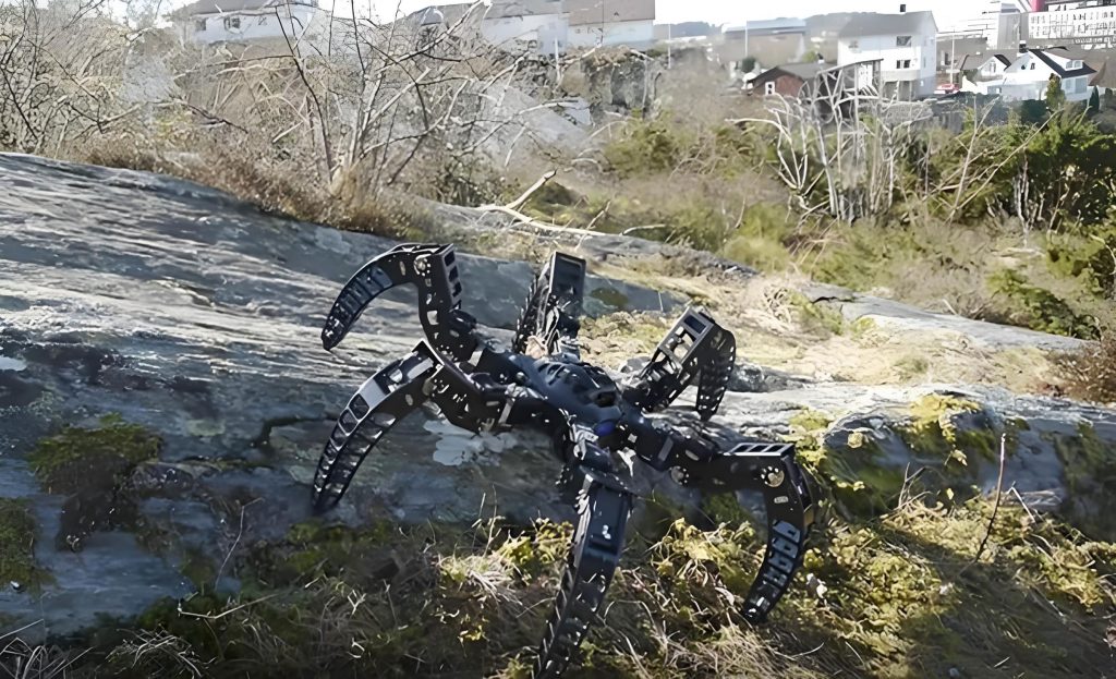
The quadruped bionic robot, inspired by the locomotion of four-legged animals, excels in adapting to dynamic and unstructured environments. Equipped with an array of sensors, including LiDAR, inertial measurement units (IMU), panoramic cameras, and mobile 3D laser mapping systems, this bionic robot can perform detailed 3D information acquisition and processing. For instance, in underground cable pipe galleries, the bionic robot executes tasks such as motion control, data collection, and visualization with high precision. The integration of these components enables the bionic robot to overcome common challenges in tunnel surveys, such as poor lighting and homogeneous textures, by leveraging real-time data fusion and advanced algorithms. In this study, we delve into the operational principles of each sensor and their synergy in enhancing the capabilities of the bionic robot.
LiDAR (Light Detection and Ranging) is a core technology in the bionic robot’s sensor suite, enabling high-resolution distance measurements through optical remote sensing. It operates by emitting laser pulses and measuring the time taken for the reflected light to return, allowing for accurate environmental mapping. The fundamental distance calculation is given by:
$$ d = \frac{c \cdot t}{2} $$
where \( d \) represents the target distance in meters, \( c \) is the speed of light (approximately \( 3 \times 10^8 \) m/s), and \( t \) denotes the round-trip time of the laser pulse in seconds. Due to the brevity of laser pulses, LiDAR achieves fine-grained spatial resolution, which is crucial for capturing detailed geometric structures in tunnels. The bionic robot utilizes this data to generate point clouds, which form the basis for 3D reconstructions. However, in dynamic environments, LiDAR alone may suffer from error accumulation; thus, it is combined with IMU for improved accuracy.
The IMU complements LiDAR by providing high-frequency measurements of linear acceleration and angular velocity, which are essential for compensating the bionic robot’s motion-induced errors. The IMU consists of accelerometers and gyroscopes that track changes in position and orientation. The displacement \( S(t) \) can be derived from Newton’s second law:
$$ S(t) = S_0 + v_0 t + \frac{1}{2} a t^2 $$
where \( S_0 \) is the initial position, \( v_0 \) is the initial velocity in m/s, and \( a \) is the linear acceleration in m/s². Similarly, the angular displacement \( \theta(t) \) is calculated as:
$$ \theta(t) = \theta_0 + \omega_0 t + \frac{1}{2} \alpha t^2 $$
with \( \theta_0 \) as the initial angle in radians, \( \omega_0 \) as the angular velocity in rad/s, and \( \alpha \) as the angular acceleration in rad/s². By integrating IMU data, the bionic robot corrects for姿态 changes during movement, ensuring precise localization and mapping. This fusion is particularly vital in tunnels where GPS signals are unavailable, and the bionic robot must rely on internal sensors for navigation.
Panoramic cameras on the bionic robot capture 360-degree imagery using fish-eye lenses or multiple standard lenses, providing color and texture information that enriches the geometric data from LiDAR. These cameras synchronize with point cloud acquisition, allowing for comprehensive environmental documentation. The resulting datasets combine spatial and visual elements, facilitating applications like structural health monitoring and anomaly detection. For example, in low-light tunnel sections, the bionic robot’s cameras employ advanced imaging techniques to maintain clarity, underscoring the adaptability of bionic robot systems.
Mobile 3D laser mapping on the bionic robot employs the FastLIO algorithm framework, a SLAM (Simultaneous Localization and Mapping) approach tailored for LiDAR-IMU integration. This framework ensures rapid and accurate map construction through a multi-step process. First, IMU pre-integration estimates the sensor’s motion between consecutive LiDAR scans. The position change \( \Delta p \), velocity change \( \Delta v \), and angular change \( \Delta \theta \) over a time interval from \( t_0 \) to \( t_1 \) are computed as:
$$ \Delta p = \int_{t_0}^{t_1} v(t) \, dt + \frac{1}{2} \int_{t_0}^{t_1} a(t) \, dt^2 $$
$$ \Delta v = \int_{t_0}^{t_1} a(t) \, dt $$
$$ \Delta \theta = \int_{t_0}^{t_1} \omega(t) \, dt $$
Next, point cloud matching aligns new LiDAR data with existing maps using algorithms like ICP (Iterative Closest Point). Optimization follows, where sensor poses are refined by minimizing errors through methods such as the Levenberg-Marquardt algorithm. Finally, the global map is updated incrementally as the bionic robot moves, resulting in a detailed 3D representation. This capability allows the bionic robot to operate autonomously in complex tunnels, demonstrating its prowess in real-time data processing.
To illustrate the practical implementation of the bionic robot, we conducted a case study in an underground cable pipe gallery. The testing area spanned approximately 530 meters between two access points, and the bionic robot was remotely controlled to perform various maneuvers, including straight-line walking, turning, slope navigation, and obstacle avoidance. The primary objectives were to assess the bionic robot’s mobility and data acquisition efficiency in a realistic tunnel environment. The bionic robot, a compact model suitable for confined spaces, was deployed to collect laser point clouds and panoramic images while maintaining a steady pace of about 0.5 m/s. The entire process, from setup to data validation, was completed within 65 minutes, highlighting the bionic robot’s rapid deployment and operational effectiveness.
The motion capability tests confirmed that the bionic robot could execute complex actions reliably, such as lying down, standing, running, and dynamically avoiding obstacles. Its endurance exceeded two hours, ensuring sustained performance during extended surveys. In terms of data acquisition, the bionic robot successfully gathered high-quality point clouds and panoramic imagery, which were processed to generate detailed 3D models. The table below summarizes the key performance metrics of the bionic robot during the tests:
| Parameter | Value | Description |
|---|---|---|
| Operating Speed | 0.5 m/s | Average walking speed in tunnel |
| Endurance | >2 hours | Continuous operation time |
| Data Collection Time | 65 minutes | Total for round-trip and processing |
| Point Cloud Accuracy | High | Based on LiDAR and IMU fusion |
| Environment Adaptability | Excellent | Performance in low-light and complex terrains |
The data processing phase involved using the FastLIO algorithm to reconstruct 3D maps from the collected point clouds. The results showed that the bionic robot could effectively handle the tunnel’s repetitive features and weak lighting, producing clear and actionable insights. For instance, the point cloud data revealed structural details that are critical for health monitoring, such as deformations or cracks. The integration of panoramic images added contextual information, enabling comprehensive analysis. The following equation exemplifies the error minimization in point cloud matching, which is central to the bionic robot’s mapping accuracy:
$$ E = \sum_{i=1}^{n} \| \mathbf{p}_i – \mathbf{q}_i \|^2 $$
where \( E \) is the total error, \( \mathbf{p}_i \) represents points from the new scan, and \( \mathbf{q}_i \) denotes corresponding points in the existing map. By iteratively reducing \( E \), the bionic robot achieves precise alignment, ensuring reliable 3D models. This process underscores the bionic robot’s ability to deliver robust data for engineering decisions.
In addition to technical performance, we evaluated the bionic robot’s logistical aspects, such as deployment ease. The compact size of the bionic robot allowed it to be transported via绳索 into confined areas, whereas larger models would be impractical. This adaptability makes the bionic robot ideal for diverse tunnel configurations. Furthermore, the real-time data transmission capabilities of the bionic robot facilitate immediate analysis, reducing the time between data collection and actionable outcomes. The table below compares the bionic robot with traditional methods, emphasizing its advantages:
| Aspect | Traditional Methods | Bionic Robot |
|---|---|---|
| Risk Level | High (manual operations) | Low (autonomous navigation) |
| Efficiency | Slow (limited coverage) | Fast (comprehensive data acquisition) |
| Data Quality | Variable (depends on human skill) | Consistently High (sensor-based) |
| Adaptability | Poor (fixed equipment) | Excellent (dynamic movement) |
| Cost Over Time | High (labor and maintenance) | Reduced (automation and reuse) |
Looking ahead, the evolution of bionic robots in tunnel engineering is closely tied to advancements in communication technologies, such as 5G networks. These will enhance the bionic robot’s data processing and transmission, enabling low-latency, high-bandwidth operations in real-time. Future bionic robots are expected to collaborate with other smart devices within tunnels, forming integrated systems for construction and maintenance. For example, a swarm of bionic robots could perform distributed sensing, covering larger areas more efficiently. The ongoing development of AI algorithms will further improve the bionic robot’s autonomy, allowing it to learn from environmental interactions and optimize its performance over time.
In conclusion, the quadruped bionic robot represents a significant leap forward in tunnel survey and monitoring, addressing the shortcomings of conventional approaches. Our research validates its efficacy in motion control, data acquisition, and 3D visualization, demonstrating that the bionic robot can operate reliably in challenging conditions like underground cable galleries. The synergy of LiDAR, IMU, and panoramic cameras, coupled with robust algorithms, empowers the bionic robot to deliver precise and actionable insights. As technology progresses, the bionic robot will play an increasingly vital role in enhancing the safety, efficiency, and intelligence of tunnel projects, solidifying its position as a cornerstone of modern infrastructure management.