
In modern transportation and urban development, tunnel engineering holds a critical position, especially in complex geological conditions such as mountainous and underground environments. Enhancing the accuracy and efficiency of survey and monitoring is a key technical challenge. Traditional methods, which rely on manual labor or fixed equipment, face limitations including high risks, low efficiency, and difficulties in covering complex terrains. With the rapid advancement of intelligent technologies, the robot dog, a type of quadruped robot, has emerged as a novel autonomous solution. These quadruped robots possess strong autonomous navigation and obstacle avoidance capabilities, enabling them to carry various sensors for data collection in complex environments, thereby offering new approaches to tunnel engineering challenges.
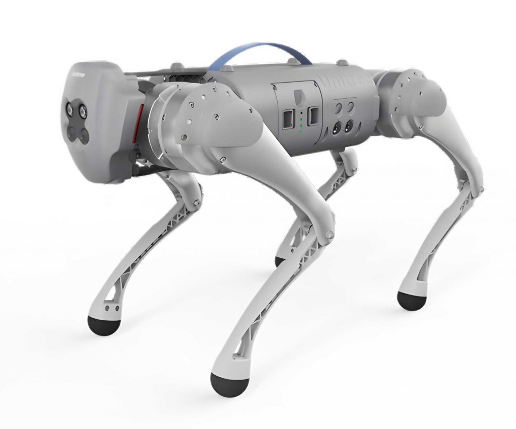
The quadruped bionic robot, resembling a four-legged animal, is designed to adapt to diverse and changing conditions. It is equipped with devices such as LiDAR, an Inertial Measurement Unit (IMU), panoramic cameras, and mobile 3D laser mapping systems. Key functionalities include 3D information acquisition and processing in low-light and repetitive feature scenarios, as well as motion control, data collection, processing, and visualization in underground cable pipe galleries. The integration of these technologies allows the robot dog to perform efficiently in challenging tunnel environments, providing reliable support for intelligent management. For instance, the robot dog can navigate through narrow passages and collect high-resolution data, which is essential for structural health monitoring. The versatility of the quadruped robot makes it a valuable tool in modern infrastructure projects.
LiDAR (Light Detection and Ranging) is an optical remote sensing technology that measures distances by emitting laser beams and receiving reflected light. The fundamental principle involves calculating the distance to a target based on the time it takes for the laser pulse to travel to the object and back. The distance \(d\) can be expressed as:
$$d = \frac{c \cdot t}{2}$$
where \(c\) is the speed of light (approximately \(3 \times 10^8\) m/s), and \(t\) is the time of flight in seconds. Due to the short duration of laser pulses, LiDAR achieves high-resolution distance measurements, making it ideal for capturing detailed 3D point clouds of tunnel interiors. The robot dog utilizes LiDAR to generate precise geometric representations of the environment, which are crucial for identifying structural anomalies. The accuracy of LiDAR in the quadruped robot enhances its ability to operate in dark or featureless tunnels where visual cues are limited.
The IMU is a critical sensor that measures linear acceleration and angular velocity using accelerometers and gyroscopes. Based on Newton’s second law, the displacement \(S(t)\) of an object can be derived from acceleration measurements. The equation for displacement is:
$$S(t) = S_0 + v_0 t + \frac{1}{2} a t^2$$
where \(S_0\) is the initial position, \(v_0\) is the initial velocity in m/s, and \(a\) is the linear acceleration in m/s². Similarly, the angular displacement \(\theta(t)\) is calculated as:
$$\theta(t) = \theta_0 + \omega_0 t + \frac{1}{2} \alpha t^2$$
where \(\theta_0\) is the initial angle in radians, \(\omega_0\) is the angular velocity in rad/s, and \(\alpha\) is the angular acceleration in rad/s². The IMU data compensates for姿态 changes in the LiDAR during movement, reducing error accumulation and improving positioning accuracy. In the context of the robot dog, the IMU ensures stable navigation through uneven tunnel surfaces, allowing the quadruped robot to maintain balance and precise data collection even on slopes or rough terrain.
Panoramic cameras capture 360-degree images using fish-eye lenses or multiple standard lenses. These cameras work in synchronization with LiDAR to collect both point cloud data and panoramic imagery. The point cloud data, generated by LiDAR, represents the geometric structure of the environment, while the panoramic images provide color and texture information. This combination enables comprehensive visualization of tunnel conditions, facilitating better analysis and decision-making. For the quadruped robot, the panoramic camera enhances its ability to document environmental details, which is vital for long-term monitoring and maintenance. The robot dog can thus create immersive visual records that complement the 3D models.
Mobile 3D laser mapping employs algorithms like FastLIO for real-time map reconstruction. FastLIO is a SLAM (Simultaneous Localization and Mapping) framework designed for LiDAR-IMU integration, focusing on fast and accurate map building. The process involves several steps: IMU pre-integration, point cloud matching, optimization, and map updating. In IMU pre-integration, the sensor’s motion state is predicted between consecutive LiDAR scans. The changes in position \(\Delta p\), velocity \(\Delta v\), and angle \(\Delta \theta\) over a time interval from \(t_0\) to \(t_1\) are given by:
$$\Delta p = \int_{t_0}^{t_1} v(t) \, dt + \frac{1}{2} \int_{t_0}^{t_1} a(t) \, dt^2$$
$$\Delta v = \int_{t_0}^{t_1} a(t) \, dt$$
$$\Delta \theta = \int_{t_0}^{t_1} \omega(t) \, dt$$
Point cloud matching aligns new LiDAR data with existing maps using algorithms like ICP (Iterative Closest Point). Optimization minimizes errors through nonlinear techniques such as the Levenberg-Marquardt algorithm, and the map is continuously updated as the quadruped robot moves. This approach allows the robot dog to construct detailed 3D maps in real-time, essential for dynamic environments like tunnels. The efficiency of this mapping process in the quadruped robot underscores its adaptability and precision in complex scenarios.
In practical applications, the quadruped robot was deployed in an underground cable pipe gallery for data collection. The testing involved evaluating the robot dog’s motion capabilities and data acquisition performance. The quadruped robot demonstrated proficiency in various movements, including straight-line walking, turning, ascending and descending slopes, and obstacle avoidance. These actions were crucial for assessing its suitability in confined tunnel spaces. The robot dog’s ability to navigate such environments highlights its potential for replacing traditional methods that are less flexible and more hazardous.
The data collection process involved the robot dog traversing a predefined path while capturing LiDAR point clouds and panoramic images. The testing covered a distance of approximately 1,100 meters, with the quadruped robot maintaining a steady pace of about 0.5 m/s. The entire procedure, including setup, data acquisition, and quality checks, was completed efficiently, demonstrating the robot dog’s operational reliability. The point cloud data obtained provided high-resolution 3D models of the tunnel, which were used for further analysis and visualization. This exemplifies how the quadruped robot can enhance survey accuracy and reduce time-consuming manual efforts.
To summarize the sensor specifications and performance metrics of the robot dog, the following table provides an overview:
| Sensor/Component | Function | Key Parameters |
|---|---|---|
| LiDAR | Distance measurement and 3D mapping | Range: up to 100 m, Accuracy: ±2 cm |
| IMU | Motion tracking and姿态 estimation | Acceleration range: ±16 g, Angular velocity: ±2000 deg/s |
| Panoramic Camera | 360-degree image capture | Resolution: 12 MP, Field of view: 360° horizontal |
| Mobile Mapping System | Real-time 3D reconstruction | Update rate: 10 Hz, Mapping accuracy: <5 cm |
The results from the motion capability tests confirmed that the quadruped robot could perform all required actions effectively, including remote control, lying down, standing, walking, running, navigating stairs, turning, dynamic obstacle avoidance, and operating in AI and reinforcement learning modes. The robot dog sustained continuous operation for over two hours, indicating robust battery life and mechanical durability. In terms of data acquisition, the LiDAR and panoramic modules functioned flawlessly, capturing comprehensive datasets. The point cloud data, as illustrated in the results, offered detailed insights into the tunnel’s structural integrity, enabling precise health monitoring. The quadruped robot’s performance in these tests validates its application in real-world tunnel engineering scenarios.
Another critical aspect is the integration of communication technologies, such as 5G, which facilitates real-time data transmission for the robot dog. With high-speed networks, the quadruped robot can stream data to central systems for immediate analysis, enhancing decision-making processes. This capability is particularly important in time-sensitive operations like emergency inspections or continuous monitoring. The robot dog’s adaptability to various communication protocols further strengthens its role in intelligent tunnel management systems.
In addition to technical specifications, the economic benefits of using a quadruped robot should be considered. Compared to traditional methods, the robot dog reduces labor costs and minimizes human exposure to hazardous environments. The following table compares traditional survey methods with the quadruped robot approach:
| Aspect | Traditional Methods | Quadruped Robot (Robot Dog) |
|---|---|---|
| Cost Efficiency | High due to manual labor and equipment setup | Lower operational costs over time |
| Safety | Risks from unstable terrains and confined spaces | Enhanced safety with remote operation |
| Data Accuracy | Variable, depending on human skill | Consistently high with sensor integration |
| Time Required | Days to weeks for comprehensive surveys | Hours to days with automated processes |
Looking ahead, the future of quadruped robots in tunnel engineering is promising. With advancements in AI and machine learning, the robot dog can evolve to perform more complex tasks, such as autonomous decision-making and predictive maintenance. For example, the quadruped robot could use historical data to identify potential structural weaknesses before they become critical. Moreover, the integration of swarm robotics could enable multiple robot dogs to collaborate on large-scale projects, improving coverage and efficiency. The continuous development of sensor technologies will further enhance the capabilities of the quadruped robot, making it an indispensable tool in smart city initiatives.
In conclusion, the robot dog, as a type of quadruped robot, represents a significant leap forward in tunnel survey and monitoring. Its ability to navigate complex environments, collect high-fidelity data, and operate safely under challenging conditions positions it as a key enabler of intelligent infrastructure management. As technology progresses, the quadruped robot will undoubtedly play an increasingly vital role in ensuring the sustainability and safety of tunnel systems worldwide. The ongoing research and practical applications demonstrate that the robot dog is not just a technological novelty but a practical solution to longstanding engineering challenges.