
Tunnel accidents, characterized by their sudden onset, high potential for catastrophic damage, and challenging rescue conditions, impose stringent demands on emergency response systems. The enclosed environment of a tunnel, formed when traversing natural barriers like mountains, rivers, or seabeds, significantly amplifies both the probability and severity of incidents. Historical data reveals that secondary accidents frequently occur shortly after the primary event. When incidents involve fire or hazardous chemical leaks, toxic fumes can rapidly accumulate, posing a grave and immediate threat to life. Consequently, rapid and effective emergency intervention is paramount for minimizing casualties, controlling escalation, restoring traffic flow, and maintaining public confidence in transportation safety. This response capability is an indispensable component of tunnel safety management, where its efficiency directly dictates the final outcome. This article explores and proposes an integrated emergency response methodology leveraging the synergistic capabilities of unmanned aerial vehicles (UAVs or drones) and quadrupedal unmanned ground vehicles (robot dogs). The objective is to achieve swift response and efficient rescue. The system employs drones for traffic warning and preliminary reconnaissance at tunnel portals, while robot dogs are tasked with internal reconnaissance, guidance, and search and rescue (SAR) operations within the tunnel. This collaborative approach overcomes the limitations of traditional methods in complex tunnel environments, effectively enhancing the efficiency and safety of tunnel emergency responses.
Current State and Limitations of Unmanned Equipment in Tunnels
The application of unmanned systems in tunnel management presents a varied landscape. Rail-mounted inspection robots have seen relatively widespread deployment in highway tunnels across China, utilized for daily inspection and emergency handling, performing functions such as environmental monitoring, traffic incident detection, infrastructure inspection, and mobile law enforcement. However, this approach faces significant challenges: a lack of unified technical standards leads to incompatibility between robots and rails from different manufacturers, hindering economies of scale, stifling technical exchange, and creating undesirable vendor lock-in for tunnel operators. Furthermore, the high development and manufacturing costs of these specialized robots present a substantial economic barrier, limiting their widespread adoption. Crucially, their dependence on fixed rails severely restricts their spatial operational range and flexibility.
In contrast, the use of drones inside tunnels remains limited primarily due to poor or non-existent GNSS navigation signals. Their application is more common in broader highway network patrols and emergency command scenarios outside tunnels. Similarly, the deployment of quadruped robot dogs in highway tunnels has been minimal, with their primary applications found in power inspection, campus patrols, and firefighting.
A critical analysis underscores that while tunnel safety is paramount and rapid emergency response is crucial, existing robotic solutions are either restrictive or underutilized. Drones, already widely deployed in general highway environments, can be strategically positioned at tunnel entrances for emergency command, maximizing resource utility through multi-functional applications. Meanwhile, robot dogs, with their superior mobility and terrain adaptability, offer a promising alternative for entering tunnels to conduct scouting and guidance operations, potentially at a lower cost than complex rail-bound systems. The future potential lies in further unlocking the capabilities of robot dogs, expanding their application scope to include routine tunnel inspection and other scenarios.
Exploring Drone and Robot Dog Synergy in Tunnel Emergency Scenarios
In an emergency scenario such as a tunnel fire or toxic gas leak, upon detection of the anomaly by traffic control center operators or an automated emergency dispatch system, a coordinated response is automatically initiated. A robot dog is dispatched to enter the tunnel interior to conduct on-site reconnaissance and initial search operations. Concurrently, a drone, equipped with audible and visual alarms, is deployed to a position approximately 500 meters ahead of the tunnel entrance to execute traffic warning functions, alerting approaching vehicles to slow down and stop. Operators at the control center can remotely control both assets, adjusting their paths, controlling pan-tilt-zoom (PTZ) camera angles, and conducting remote hailing. This enables rapid reaction and preliminary handling of the tunnel emergency. The synergistic workflow is conceptualized below.
The core of this methodology is a purposeful division of labor based on the inherent strengths of each platform:
| Platform | Primary Deployment Zone | Key Emergency Functions | Operational Advantage |
|---|---|---|---|
| Drone (UAV) | External (Tunnel Approach) | Aerial Traffic Warning, Perimeter Reconnaissance, Remote Hailing | Rapid aerial deployment, wide field of view, effective for alerting distant traffic. |
| Robot Dog (Quadruped UGV) | Internal (Tunnel Bore) | Internal Reconnaissance, Gas Detection, Search & Rescue, Guidance Hailing | Agile ground mobility in confined/complex spaces, operates without GNSS, direct interaction potential. |
This synergy overcomes singular platform limitations: the drone provides the crucial early warning and situational overview from a safe external vantage point, while the robot dog penetrates the hazardous interior environment where drones may be ineffective due to smoke, heat, or lack of flight space, gathering vital intelligence and performing initial response tasks.
System Design Methodology
1. Unmanned Equipment Selection and Configuration
The selection of platforms and their configuration is critical for mission success. The design prioritizes reliability, functionality, and operational autonomy.
Drone (UAV) Selection: A medium-sized drone is selected for remote imaging data collection. Its size provides sufficient visibility to attract the attention of drivers. Key payloads and features include:
- A high-resolution visible-light camera for primary data acquisition.
- Integrated warning strobes to enhance visual conspicuity.
- A loudspeaker for remote hailing and issuing audio instructions.
- A 4G video transmission backup module to maintain data uplink if other communication channels fail.
- Integration with an Automated Drone Nest (Drone-in-a-Box): The nest houses, charges, and deploys the drone automatically. It is equipped with a 4G communication module and an Uninterruptible Power Supply (UPS) to ensure connectivity and operation during power outages. The nest interfaces with a cloud-based management platform for remote monitoring and control.
The relationship between drone components and systems can be summarized as meeting core functional requirements:
$$
\text{Drone System Capability} = f(\text{Imaging}_{HR}, \text{Alert}_{Vis/Aud}, \text{Comms}_{4G}, \text{Autonomy}_{Nest})
$$
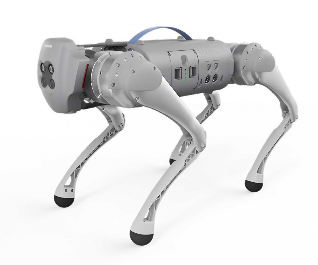
Robot Dog Selection: A versatile quadruped robot dog forms the core of the internal response unit. Its configuration is tailored for the harsh, complex tunnel interior:
- A high-resolution optical camera for general imaging.
- An infrared (thermal) camera for locating persons through smoke or in low-visibility conditions.
- Gas sensors (e.g., for CO, LEL, VOCs) to monitor air quality and detect hazardous leaks.
- A loudspeaker for ground-level hailing to guide trapped individuals.
- A dedicated charging station with UPS support, allowing the robot dog to autonomously dock and recharge, ensuring prolonged mission readiness.
- Communication via a wireless mesh network within the tunnel, with the charging station acting as a proxy to the cloud platform. A 4G backup link maintains connectivity if the mesh network is disrupted.
The operational readiness of a robot dog unit can be modeled as a function of its core subsystems:
$$
R_{robot\ dog}(t) = A_{bat}(t) \cdot \left( \sum_{i} (w_i \cdot S_{sensor,i}) + C_{comms} + M_{mobility} \right)
$$
Where \( R_{robot\ dog}(t) \) is the readiness state at time \( t \), \( A_{bat}(t) \) is the battery availability function (linked to the charging station), \( S_{sensor,i} \) are the capabilities of various sensors (optical, thermal, gas) with weights \( w_i \), \( C_{comms} \) is the communication link status, and \( M_{mobility} \) is the terrain mobility coefficient.
The key specifications for the selected platforms are contrasted below:
| Parameter / Feature | Drone (Medium) | Robot Dog (Quadruped) |
|---|---|---|
| Primary Operational Domain | Air, Tunnel Exterior | Ground, Tunnel Interior |
| Core Mission Payloads | HR Camera, Warning Lights, Speaker | HR Camera, Thermal Camera, Gas Sensors, Speaker |
| Key Locomotion Feature | Aerial Mobility, Hover | Legged Mobility, Terrain Adaptation |
| Navigation in Tunnel | GNSS-based (external), Visual-Inertial | LiDAR/Visual SLAM, Mesh Network Beacons |
| Endurance & Support | Automated Nest (Charging, Deployment) | Dedicated Charging Station (with UPS) |
| Primary Communication | 4G, Radio Link | Wireless Mesh Network, 4G Backup |
| Resilience to Hazards | Limited by smoke/wind; external ops | Designed for confined spaces, poor air quality |
2. Software Platform Architecture
To manage the heterogeneous fleet of drones and robot dogs effectively, a unified Unmanned Intelligent Agent Management and Control Platform (UAMCP) is essential. This enterprise-level middle platform consolidates control capabilities, preventing redundant development across departments, centralizing data storage, enabling asset sharing, and optimizing resource utilization.
2.1 Business Architecture
The UAMCP provides a comprehensive suite of services. It interfaces seamlessly with various unmanned devices (southbound) and offers standardized APIs for easy integration with upper-layer business application systems (northbound), such as an Emergency Command and Dispatch System (ECDS). The core functional modules of the platform include:
| Module | Core Functions |
|---|---|
| Device Management | Unified asset management for drones, robot dogs, nests, stations, and payloads. |
| Task & Path Management | Planning and management of operational paths and task sequences for all agents. |
| Mission Planning & Records | Scheduling of automated missions and management of execution logs. |
| Data Management | Storage and management of collected media (images/video) and historical trajectory data. |
| Real-time Monitoring & Control | Live video streaming, real-time telemetry display, and remote manual control of agents. |
| Application Management | Management of integrated third-party business applications. |
| Data Analysis | Statistical analysis and reporting on platform operations and mission data. |
| System Administration | User, role, organization, and log management. |
2.2 Application Architecture
Built on a layered, demand-oriented design, the application architecture integrates cloud computing, GIS, IoT, and AI technologies.
- Technology Platform Layer: Leverages private cloud for resource deployment, DevOps for streamlined development, and monitoring platforms for system observability.
- Base Capability Layer: Incorporates a GIS engine for map visualization and path planning, and an AI platform for intelligent video analytics (e.g., automatic fire/accident detection) and integration with Digital Elevation Models (DEM) for automated route generation.
- Platform Service Layer: Features modular services including an agent access service for multi-vendor device connectivity, an application operation service for daily management, and standardized northbound APIs.
- Presentation Layer: A PC-based web application provides the primary user interface for all platform functionalities.
2.3 Technical Architecture
The technical stack is designed to support the robust, scalable, and real-time requirements of the UAMCP.
- Infrastructure Layer: Provides compute, storage, and network resources via the private cloud.
- Data Management Layer: Employs a polyglot persistence model: a relational database (e.g., MySQL) for business data; a time-series database (e.g., InfluxDB) for metrics; object storage for media files; a document database (e.g., MongoDB) for logs; and a cache database (Redis) for session tokens and real-time device states.
- Base Function Layer: Utilizes GIS libraries (e.g., Cesium/Mapbox) for 2D/3D mapping, pathfinding algorithms, and a media server (e.g., SRS/Janus) for live video streaming.
- Middle Platform Service Layer: Backend services are developed with Java 17 and the Spring Boot framework. MyBatis-Plus simplifies data access. XXL-Job handles scheduled tasks. EMQX (MQTT broker) and Redis Pub/Sub manage device telemetry and command distribution.
- API Interface Layer: Nginx acts as a reverse proxy and load balancer. RESTful APIs and WebSocket interfaces are exposed for system integration and real-time data push.
- User Interface Layer: The frontend is built with Vue.js, Element-UI, and GIS SDKs to create an interactive, responsive web application.
3. Exemplary Operational Workflow
A pre-defined, automated workflow exemplifies the system’s response efficiency. Upon receiving an alert (e.g., for fire) from the integrated ECDS, the following sequence is triggered:
- Mission Activation: The ECDS invokes the UAMCP’s API, sending a predefined emergency mission profile.
- Coordinated Dispatch:
- The UAMCP commands the drone nest to launch. The drone autonomously flies to its pre-programmed hovering point 500m ahead of the tunnel entrance, activating warning lights and broadcasting pre-recorded or live audio alerts to stop approaching traffic.
- Simultaneously, the UAMCP dispatches the robot dog from its station. The robot dog enters the tunnel and begins its pre-mapped inspection route.
- Data Acquisition & AI Analysis:
- The robot dog streams live video and sensor data (gas levels, thermal feed) back to the UAMCP via the mesh network.
- The platform’s integrated AI video analytics module processes the stream in near-real-time, flagging potential incidents (flames, vehicle wreckage) for operator confirmation.
- The thermal camera feed from the robot dog is used to locate trapped individuals based on heat signatures.
- Remote Intervention & Guidance:
- Operators in the control center can manually take control: Piloting the drone to focus on specific traffic lanes or using its speaker for targeted instructions.
- Operators can direct the robot dog to approach specific locations, use its speaker to communicate with survivors, and guide them to safety, all while monitoring environmental hazards through its sensors.
The overall system response time \( T_{response} \) can be modeled as the sum of sequential and parallel processes:
$$
T_{response} = T_{detect} + \max(T_{drone\_launch} + T_{drone\_transit},\ T_{robot\ dog\_launch} + T_{robot\ dog\_transit}) + T_{data\_to\_ops}
$$
Where \( T_{detect} \) is the initial event detection time, the \( max() \) term represents the parallel deployment of the two agents (the slower of the two arrival times dominates), and \( T_{data\_to\_ops} \) is the latency for initial data to reach the operators. The synergy aims to minimize each component, especially the parallel transit times.
Application Performance Analysis
The proposed synergistic system offers quantitative and qualitative improvements over conventional response methods.
1. Enhanced Response Speed: The automated dispatch and the ability of unmanned agents to move directly to the scene bypassing surface traffic reduce the initial assessment time from tens of minutes to a matter of minutes. This represents a multiple-fold improvement in initial response speed, which is critical for preventing secondary accidents and initiating rescue.
2. Superior Situational Awareness: The multi-perspective data collection (aerial external and ground-level internal) provides a comprehensive operational picture. High-resolution visual, thermal, and environmental sensor data from the robot dog delivers accurate information for decision-making, far surpassing the limited data typically available from fixed tunnel cameras, especially in smoky conditions.
3> Environmental Adaptability and Reliability: The system design specifically addresses tunnel challenges. The robot dog is inherently suited for GNSS-denied, confined, and potentially hazardous interiors. Redundancy measures—backup 4G links, UPS systems on nests and charging stations, and autonomous recharge capabilities—ensure sustained operation during infrastructure failure.
4. Platform Stability: Medium drones offer sufficient stability for external operations in various wind conditions. The dynamic gait control and advanced stabilization algorithms of modern quadruped robot dogs ensure stable locomotion on uneven tunnel floors, debris, and in confined spaces, which is a significant advantage over wheeled or tracked platforms.
5. Multi-Scenario Efficacy: The system is versatile.
| Emergency Scenario | Drone Role | Robot Dog Role | Synergistic Benefit |
|---|---|---|---|
| Tunnel Fire | External traffic control, aerial overview. | Internal recon through smoke (thermal vision), gas monitoring, locating survivors, guiding evacuation. | External traffic management prevents congestion at portal while internal rescue intelligence is gathered safely. |
| Major Traffic Accident | Aerial warning to prevent secondary collisions, assessing external queue length. | Inspecting crash site, checking for occupants in deformed vehicles, delivering first-aid supplies if equipped. | Rapid isolation of the incident zone coupled with immediate ground-level assessment. |
| Hazardous Material Leak | Broadcasting safety instructions from a safe stand-off distance. | Precise identification of leak source, real-time gas concentration mapping, assessing spread within tunnel. | Provides critical data on internal contamination levels without exposing human responders, informing safe entry protocols. |
The overall system effectiveness \( E_{system} \) for a given scenario can be conceptualized as a weighted function of these key performance indicators (KPIs):
$$
E_{system} = \alpha \cdot \frac{1}{T_{response}} + \beta \cdot I_{data} + \gamma \cdot R_{system} + \delta \cdot A_{scenario}
$$
Where:
- \( \frac{1}{T_{response}} \) is the inverse of response time (higher is better).
- \( I_{data} \) is an index of data richness and accuracy provided.
- \( R_{system} \) is a measure of system reliability and uptime.
- \( A_{scenario} \) is an adaptability score for the specific emergency type.
- \( \alpha, \beta, \gamma, \delta \) are weighting coefficients reflecting operational priorities.
The proposed drone and robot dog system is designed to maximize \( E_{system} \) by optimizing each KPI.
Conclusion and Future Outlook
This article presents a novel tunnel emergency response system based on the synergistic application of drones and robot dogs. The system demonstrates significant advantages in terms of response speed, data acquisition capability, environmental adaptability, and operational reliability. By effectively combining the aerial perspective and alerting function of drones with the ground-level penetration, reconnaissance, and interaction capabilities of the robot dog, it addresses critical gaps in traditional tunnel emergency management. This approach substantially enhances the efficiency and safety of incident response, promising to reduce casualties and secondary losses.
The future development of this system is promising. Beyond emergency response, the robot dog platform can be utilized for routine tunnel inspection tasks, such as monitoring structural health, checking lighting and signage, and detecting early-stage hazards, providing continuous value and improving return on investment. Similarly, drone fleets managed by the central UAMCP can be efficiently tasked for routine inspections of other highway assets like slopes, bridges, and embankments, maximizing resource utilization and elevating the overall efficiency and quality of highway maintenance operations. The integration of more advanced AI for autonomous decision-making, improved human-agent teaming interfaces, and swarming capabilities for multiple robots working together represent exciting avenues for further research and development, solidifying the role of intelligent unmanned systems in safeguarding critical transportation infrastructure.